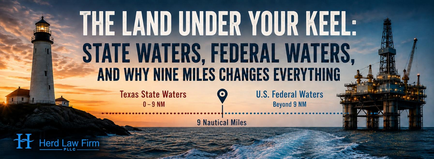
Second in our series on the law of the water. The first post traced the great lines that divide the sea; this one walks the boundary that matters most to a Texas mariner — the nine-mile line where state law gives way to federal, and where the very same accident can carry a very different remedy.
In our first post of this series, we began on a Texas shoreline and proceeded from there, crossing the great zones of international maritime law — the territorial sea, the Exclusive Economic Zone (EEZ), the High Seas. But the line that matters most to the people who actually work on the water is not a hundred miles out. It is roughly nine miles out, and almost no one who crosses it would ever notice a thing. On one side of the line, you’re in Texas. On the other, you are in the United States — and the difference can decide which law protects you when something goes wrong.
Two Rules, One Coast
For most of American history, no one bothered to ask who owned the water just off the beach — until oil was found beneath it. In United States v. California (1947), the U.S. Supreme Court handed the federal government the seabed off the coast, reasoning that national defense and foreign relations outweighed state claims. The coastal states pushed back hard, and Congress answered with the Submerged Lands Act (SLA) of 1953, which gave each coastal state the seabed and resources out to 3 nautical miles (nm) from its coastline. Beyond that line, the water belongs to the nation.
Why Texas Reaches Farther
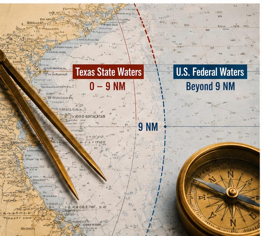
Texas is one of only two exceptions (the Gulf coast of Florida is the other): our boundary runs three marine leagues — about 9 nautical miles, or roughly 10 land miles — out into the Gulf. The reason: Texas history. When Texas was an independent Republic, it claimed a three-league sea boundary; Congress honored that claim when Texas joined the Union in 1845; the Supreme Court confirmed it in United States v. Louisiana (1960), with the boundary later fixed by decree in 1969. A marine league is three nautical miles, so three leagues is that nine-mile line — a border first drawn by a fledgling republic and still under your keel today.
What Changes When You Cross the Line
Here is the part that matters to a working mariner: crossing that line can change the rulebook. Which body of law applies to an injury on the water turns on two things — situs (where it happened) and status (what you were doing there):
- Seamen follow their vessel. If you are a “seaman” — a crewmember of a vessel in navigation — the Jones Act protects you wherever that vessel sails, in state water or federal. Your status travels with you across every line.
- Platform and fixed-structure workers follow the seabed. Beyond the nine-mile line, on the Outer Continental Shelf (OCS), the Outer Continental Shelf Lands Act (OCSLA) takes over. A worker on a fixed platform out there generally is not a Jones Act seaman; instead, the Longshore and Harbor Workers’ Compensation Act (LHWCA) provides no-fault benefits, and — importantly — OCSLA borrows the law of the adjacent state (for us, Texas) as “surrogate” federal law, to fill any gaps.
- Inside state water, Texas has a preceding say. Within the nine-mile line, general maritime law still governs many claims, but Texas law can reach further into an incident than it can on the federal shelf beyond.
So the same line can quietly change three things at once: which law governs, which court hears the case, and what an injured worker can recover — and by when. Deadlines differ, damages differ, and even the courthouse differs.

Same Wave, Two Rulebooks
Picture two Gulf workers on the same gray and stormy morning. A deckhand on a crew boat takes a fall as she pitches in a swell; as a seaman, he is covered by the Jones Act whether the boat is three miles out or thirty. Twelve miles away, past the nine-mile line, a roustabout on a fixed production platform takes the very same fall — but he is an OCSLA worker, so his claim runs through the LHWCA, and Texas negligence law may fill in only around the edges. One Gulf, one storm, two entirely different paths to recovery. Getting that map right early is often the difference between a claim that succeeds and one that never gets off the ground.
Why This Is More Than a Map
The lines we draw on the water are invisible, but their consequences are not. Where an injury happens, and what the injured person was doing, can determine much of the case before the facts are even argued. That is exactly why we press these questions early — a theme that runs through our writing on the Jones Act and seafarer rights.
In our next installment, we’ll leave the coast behind entirely and head for the open sea, where a very different question waits: once a ship is past every one of these lines, whose rules follow her?
⚓ Maritime Trivia
Q: What does it mean when a sailing vessel is “in irons” — and where did the phrase come from?
A: A vessel is “in irons” when she points directly into the wind, loses momentum, and can no longer sail or steer effectively. The phrase comes from the older use of “irons” for shackles or restraints placed on prisoners. Sailors borrowed the expression for a ship caught head-to-wind: like a person in irons, she is temporarily restrained and unable to move freely until the crew gets her bow off the wind.
We at the Herd Law Firm are proud to fight for seamen, maritime workers, shippers, and passengers in all types of personal injury, death, and maritime commercial claims. As maritime attorneys (and sailors ourselves!) located in northwest Houston, we never waver in our commitment to help maritime workers, businesses, and their families when they are injured, mistreated, or shortchanged.
The information in this post is for general informational purposes only and does not constitute legal advice. For questions specific to your maritime law issue, please contact us at 713-955-3699, at Charles.Herd@HerdLawFirm.com, or at our office at 8826 Louetta Road, Suite 310, Spring, Texas 77379.
Sources
1. U.S. Bureau of Ocean Energy Management (BOEM), “The Submerged Lands Act of 1953” — boem.gov.
2. U.S. Bureau of Safety and Environmental Enforcement (BSEE), “Governing Statutes” (SLA, OCSLA; Texas & Florida three marine leagues) — bsee.gov.
3. NOAA Office of Coast Survey, “U.S. Maritime Limits and Boundaries” — nauticalcharts.noaa.gov.
4. United States v. Louisiana (Texas Boundary Case), 394 U.S. 1 (1969), affirming Texas’s three-league Gulf boundary under United States v. Louisiana, 363 U.S. 1 (1960) — govinfo.gov.
5. Florida Sea Grant, “Understanding Florida’s State Waters” (history of the Texas and Florida three-league lines) — flseagrant.org.
6. Outer Continental Shelf Lands Act, 43 U.S.C. § 1333 (federal jurisdiction on the OCS; adjacent-state law as surrogate federal law) — law.cornell.edu.
7. Jones Act, 46 U.S.C. § 30104 — law.cornell.edu.
8. Longshore and Harbor Workers’ Compensation Act, 33 U.S.C. § 901 et seq. — law.cornell.edu.